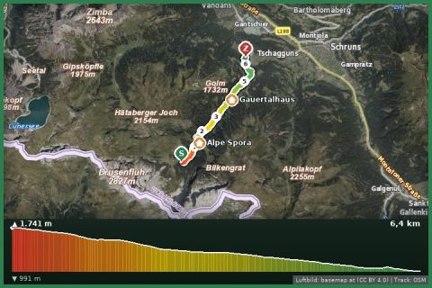
 Aerial imagery basemap.at (CC BY 4.0) · track OSM
Hüttentour Lünersee/Rätikon "Leicht" - Lindauer Hut bis Latschau
Montafon
Aerial imagery basemap.at (CC BY 4.0) · track OSM
Hüttentour Lünersee/Rätikon "Leicht" - Lindauer Hut bis Latschau
Montafon
moderate
Short but steep summit climb from the Lindauer Hütte to the Geißspitze – a front-row seat opposite the Drei Türme and Sulzfluh.
The Geißspitze (2,334 m) is the lookout peak above the Lindauer Hütte. The marked trail gains around 600 m in just under two kilometres: first through dwarf pines and alpine meadows, then more steeply over rocky slopes and scree to the summit ridge that runs across to the Golm. You need sure footing and a head for heights; there are no technically difficult sections.
At the top you stand directly opposite the limestone walls of the Rätikon – Drei Türme, Sulzfluh, Zimba – and look across to the Silvretta; many hikers from Austria and abroad describe the summit as the most rewarding viewpoint of the Gauertal. A popular combination uses the Golm cable car: from the summit station along the Golmer Höhenweg to the Geißspitze, down the trail to the hut, then back to the cable car on the Latschätzer trail. Allow about 1½ to 2 hours for the ascent from the hut.
From the Lindauer Hütte follow signs for “Geißspitze”. Trail over alpine meadows and rocky slopes to the summit; descend the same way or via the Golmer Höhenweg to the Golm summit station.
Start early – the summit is often in cloud by afternoon. Sturdy boots; the upper section is slippery when wet.
Montafonerbahn to Vandans or Tschagguns, Landbus to the Golm cable car in Vandans/Latschau (Golm valley station). From St. Gallenkirch: bus 650 with change in Schruns.
Free parking at the Golm cable car in Vandans and in Latschau (mid station/Gauertal car park, partly paid in summer).
Emergency: Alpine rescue 140 · Euro emergency 112 · Ambulance 144
All information without guarantee. Please check weather, opening hours and cable car operating times before setting off. Alpine tours require personal responsibility, suitable equipment and experience.
📚 Listed in: OpenStreetMap
Last updated: 13 Sep 2026 · Map data © OpenStreetMap contributors (ODbL)
Aerial imagery basemap.at (CC BY 4.0) · track OSM
Hüttentour Lünersee/Rätikon "Leicht" - Lindauer Hut bis Latschau
Montafon
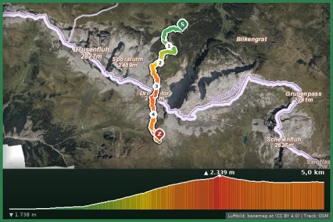 Aerial imagery basemap.at (CC BY 4.0) · track OSM
Hüttentour Rätikon Süd - Lindauer Hut bis Carschinahütte (CH)
Montafon
Aerial imagery basemap.at (CC BY 4.0) · track OSM
Hüttentour Rätikon Süd - Lindauer Hut bis Carschinahütte (CH)
Montafon
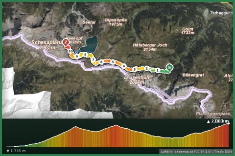 Aerial imagery basemap.at (CC BY 4.0) · track OSM
Montafoner Hut circuit | Lindauer Hut bis Totalphütte
Montafon
Aerial imagery basemap.at (CC BY 4.0) · track OSM
Montafoner Hut circuit | Lindauer Hut bis Totalphütte
Montafon