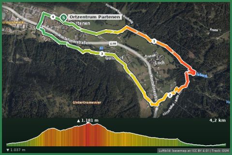
 Aerial imagery basemap.at (CC BY 4.0) · track OSM
Energieweg
Partenen
Aerial imagery basemap.at (CC BY 4.0) · track OSM
Energieweg
Partenen
easy 👨👩👧 Family friendly 🎫 Card
33 km along the Ill through the whole Montafon – in stages from village to village, always gently downhill, back by train and bus. The Gortipohl–St. Gallenkirch section starts at our doorstep.
The Illweg follows the river from the head of the valley in Partenen (1,050 m) to Bludenz (570 m). The State of Vorarlberg lists it as a regional main route and OpenStreetMap records it as a named hiking route – we merged both sources. Over 33 km the trail loses just under 500 m of altitude and climbs only briefly in a few places, making it the easiest long walk in the valley. It can be split as you like because the Montafonerbahn railway and the Landbus run parallel almost everywhere.
The natural stages: Partenen – Gaschurn (approx. 4 km, past the Rifa reservoir), Gaschurn – St. Gallenkirch via Gortipohl (approx. 6 km – our holiday house is a few minutes from the path here), St. Gallenkirch – Schruns/Tschagguns (approx. 8 km, riverside woodland), Schruns – Vandans (approx. 5 km) and Vandans – Lorüns – Bludenz (approx. 10 km through the narrow valley). The surface alternates between gravel, tarmac and forest track; large sections double as the Ill cycle path, so watch out for cyclists. Pushchairs manage most sections.
The Illweg is at its best in spring and autumn, when the high trails are still or already snowy, and on hot summer days in the shade of the riverside woods. There are places to eat in every village; in Gaschurn the Maria Schnee chapel is worth a detour, in Schruns the local history museum.
Our tip from the house: take Landbus 650 to Partenen and walk down the valley – it is downhill and you can stop at any bus stop. The trail is signposted “Illweg” throughout and follows the river, changing banks over bridges in a few places.
Landbus and Montafonerbahn are free within the valley with the Montafon guest card. Start early in high summer – parts of the path are in full sun. After rain the Vandans–Lorüns section can be muddy.
Landbus 650 to Partenen (terminus), Tafamunt and Vermunt cable cars a 5-minute walk; approx. 20 min from St. Gallenkirch.
Free parking at the Tafamunt/Vermunt cable cars in Partenen.
Emergency: Alpine rescue 140 · Euro emergency 112 · Ambulance 144
All information without guarantee. Please check weather, opening hours and cable car operating times before setting off. Alpine tours require personal responsibility, suitable equipment and experience.
📚 Listed in: OpenStreetMap · Vorarlberg hiking route network
Last updated: 13 Sep 2026 · Map data © OpenStreetMap contributors (ODbL)
Aerial imagery basemap.at (CC BY 4.0) · track OSM
Energieweg
Partenen
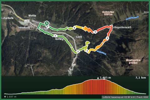 Aerial imagery basemap.at (CC BY 4.0) · track OSM
Zu den rauschenden Wasser from Ganifer
Partenen
Aerial imagery basemap.at (CC BY 4.0) · track OSM
Zu den rauschenden Wasser from Ganifer
Partenen
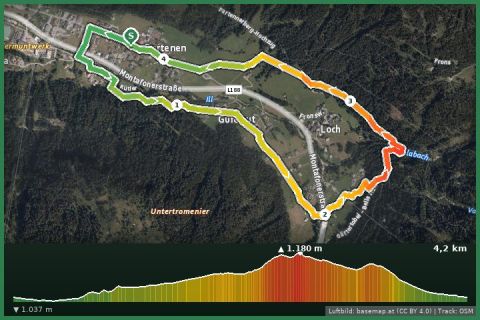 Aerial imagery basemap.at (CC BY 4.0) · track OSM
A3: Dorfrunde Partenen
Partenen
Aerial imagery basemap.at (CC BY 4.0) · track OSM
A3: Dorfrunde Partenen
Partenen