 Aerial imagery basemap.at (CC BY 4.0) · track OSM
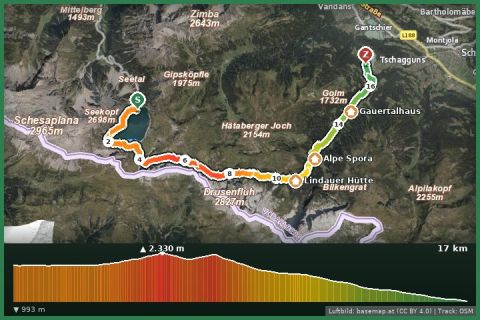
Vom Lünersee via Verajoch, Öfapass, Lindauer Hut to Latschau
Vandans/Brand · Vorarlberg
Aerial imagery basemap.at (CC BY 4.0) · track OSM
Vom Lünersee via Verajoch, Öfapass, Lindauer Hut to Latschau
Vandans/Brand · Vorarlberg
moderate 🎫 Card
Around the Lünersee at 1,970 m: 6 km of wide gravel path, the Schesaplana mirrored in the water – Vorarlberg’s best-loved family hike.
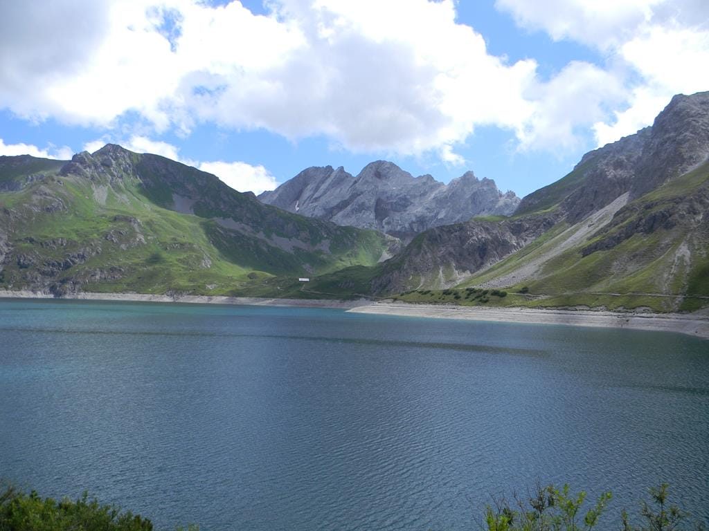
At 112 hectares the Lünersee is Vorarlberg’s largest mountain lake and one of the most photographed spots in the Alps. The Lünersee cable car takes you up from the valley station in the Brandnertal (1,583 m) in a few minutes; the loop follows a wide gravel path around the lake in about 1¾ hours – around 6 km and 100 m of elevation, with the Douglasshütte at the start, benches on the shore and the Schesaplana (2,965 m) as backdrop. Travel blogs from the USA, UK and Netherlands regularly list it among Austria’s most beautiful hikes.
For more, climb to the Totalphütte (2,385 m) in 2¾ hours or cross the Lünerkrinne into the Rellstal. Swimming and boating are prohibited – the lake is a drinking-water reservoir. On fine weekends the car park fills early; the drive from St. Gallenkirch takes 50 minutes via Bludenz and Brand, bus 580 from Bludenz.
The route leads from Lünersee via Lünersee and back to the starting point.
The plotted track follows the marked trails according to OpenStreetMap; see the map, elevation profile and GPX file above. Please follow the signposting on site.
Take the first cable car (8 am) – the lake is still calm and mirror-smooth then. Feasible with a large-wheeled pushchair.
Montafonerbahn to Bludenz, Landbus 580 to the Lünersee cable car (approx. 1 h 15 in total).
Paid car park at the valley station, full early on fine days.
Emergency: Alpine rescue 140 · Euro emergency 112 · Ambulance 144
All information without guarantee. Please check weather, opening hours and cable car operating times before setting off. Alpine tours require personal responsibility, suitable equipment and experience.
📚 Listed in: Vorarlberg hiking route network · OpenStreetMap
Last updated: 13 Sep 2026 · Map data © OpenStreetMap contributors (ODbL)
Aerial imagery basemap.at (CC BY 4.0) · track OSM
Vom Lünersee via Verajoch, Öfapass, Lindauer Hut to Latschau
Vandans/Brand · Vorarlberg
 Aerial imagery basemap.at (CC BY 4.0) · track OSM
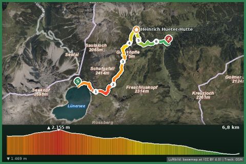
Vom Lünersee via the Lünerkrinne ins Rellstal
Vandans/Brand · Vorarlberg
Aerial imagery basemap.at (CC BY 4.0) · track OSM
Vom Lünersee via the Lünerkrinne ins Rellstal
Vandans/Brand · Vorarlberg
 Aerial imagery basemap.at (CC BY 4.0) · track OSM
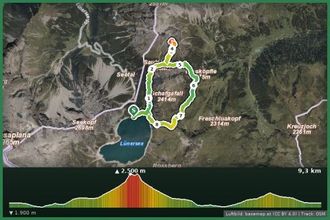
Gipfeltour Saulakopf Ostwand
Vandans/Brand · Vorarlberg
Aerial imagery basemap.at (CC BY 4.0) · track OSM
Gipfeltour Saulakopf Ostwand
Vandans/Brand · Vorarlberg