 Aerial imagery basemap.at (CC BY 4.0) · track OSM
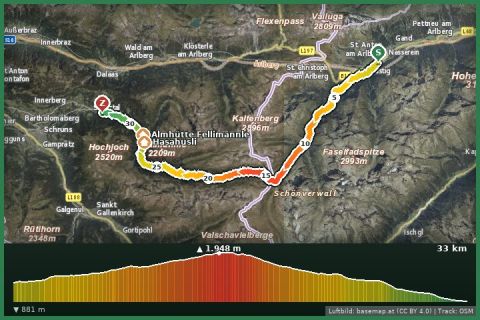
T33 Hike 33 km (Montafon Arlberg Marathon St. Anton at the Arlberg)
Montafon · Vorarlberg
Aerial imagery basemap.at (CC BY 4.0) · track OSM
T33 Hike 33 km (Montafon Arlberg Marathon St. Anton at the Arlberg)
Montafon · Vorarlberg
moderate
Around the mountain village of Stuben (1,407 m) at the foot of the Arlberg pass: 5.8 km, 200 m of ascent, views of the Flexen pass and Albona – a trip to the Klostertal, 40 minutes from the house.
Stuben is the last village of the Klostertal before the Arlberg pass and the birthplace of ski pioneer Hannes Schneider. The Stuben loop – a local route in the state trail network and mapped in OpenStreetMap – circles the village in just under 6 km: from the Rauz alp at the Flexen gallery down to the old Arlberg road, along the young Alfenz river to the Passür tunnel, through the village centre with its church and Hannes Schneider memorial and back up across meadow slopes to the start. Between 1,335 and 1,505 m that adds up to about 200 m of ascent, mostly on gravel and meadow paths.
The loop is a fine addition to a trip over the Arlberg or into the Klostertal: in summer the Albona lift runs up the mountain, and the Lechweg and Arlbergweg long-distance trails are just around the corner. From the holiday house you reach Stuben via Bludenz and the Arlberg road in about 40 minutes; the drive through the narrow Klostertal is an experience in itself.
Park in Stuben (village centre) or at the Rauz alp. Signposted “Stubener Rundweg”; the loop can be walked in either direction.
Above 1,400 m snow often lingers until May – this is an early-summer and autumn walk. Bus 90/92 links Bludenz with Stuben (Klostertal–Arlberg).
Landbus Montafon (lines 650/670/680) and Montafonerbahn Bludenz–Schruns; connections at vmobil.at.
Please check parking at the starting point on site (hiking car parks are usually signposted).
Emergency: Alpine rescue 140 · Euro emergency 112 · Ambulance 144
All information without guarantee. Please check weather, opening hours and cable car operating times before setting off. Alpine tours require personal responsibility, suitable equipment and experience.
📚 Listed in: OpenStreetMap · Vorarlberg hiking route network
Last updated: 13 Sep 2026 · Map data © OpenStreetMap contributors (ODbL)
Aerial imagery basemap.at (CC BY 4.0) · track OSM
T33 Hike 33 km (Montafon Arlberg Marathon St. Anton at the Arlberg)
Montafon · Vorarlberg
 Aerial imagery basemap.at (CC BY 4.0) · track OSM
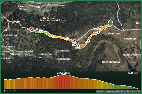
Vom Klostertal via the Muttjöchle zurück ins Montafon
Montafon
Aerial imagery basemap.at (CC BY 4.0) · track OSM
Vom Klostertal via the Muttjöchle zurück ins Montafon
Montafon
 Aerial imagery basemap.at (CC BY 4.0) · track OSM
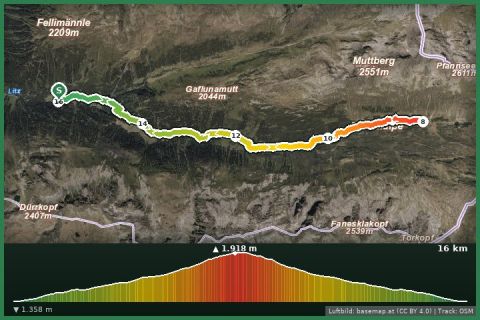
Untere Gaflunaalpe bis Langsee and retour
Montafon
Aerial imagery basemap.at (CC BY 4.0) · track OSM
Untere Gaflunaalpe bis Langsee and retour
Montafon