 Aerial imagery basemap.at (CC BY 4.0) · track OSM
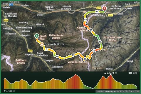
Verwalltour - from the Montafon to the Arlberg
Montafon
Aerial imagery basemap.at (CC BY 4.0) · track OSM
Verwalltour - from the Montafon to the Arlberg
Montafon
difficult
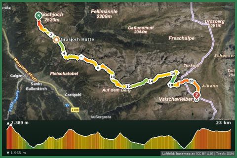
The great Verwall high route: 20 km over Grasjoch, Valschavieljöchle and the Scheidsee, always between 2,000 and 2,400 m – one of the most impressive day stages in the Montafon.
The Wormser Höhenweg links the two big Verwall huts of the Montafon and is the core section of the Montafon hut circuit. The State of Vorarlberg grades it as a mountain trail (white-red-white); OpenStreetMap records it with all intermediate points: from the Wormser Hütte (2,307 m) the path first descends to the Furkla at the Grasjoch, where in summer the Grasjoch cable car offers a convenient way in or out, then crosses the ridge of the Roßberg and follows a long crest eastwards. Via the Valschavieljöchle (about 2,400 m, the highest point) you reach the lonely Valschavielsee, traverse the cirques below the Madererspitze and pass the Scheidsee (2,271 m) to arrive at the Neue Heilbronner Hütte at 2,320 m on the Tyrolean border.
The numbers: about 20 km, a good 1,000 m of ascent and slightly more descent, 7 to 8 hours of pure walking time. The route is nowhere technically difficult, but it demands sure-footedness on a few steep rocky passages, stamina and a reliable weather window – the only shelter en route is the Grasjoch Hütte. As a two-day tour from the holiday house: Hochjoch cable car and the Seeweg to the Wormser Hütte, overnight stay, then the high route on day two and descent from the Heilbronner Hütte via Tafamunt to Partenen (bus back to Gortipohl).
Approach the Wormser Hütte via the Seeweg from Kapell (Hochjoch cable car) or take the Grasjoch cable car from St. Gallenkirch to the Furkla (saves 300 m of climbing). Signposted “Heilbronner Hütte” / Wormser Höhenweg. Descend from the Heilbronner Hütte to Partenen via Tafamunt (approx. 3 h) or to the Zeinisjoch (summer bus).
Book beds at both huts in advance. Start early – thunderstorm risk on the ridge in the afternoon. Carry spare food – there is nothing between the Grasjoch and the Heilbronner Hütte. The path is part of the Zentralalpenweg 02A.
Montafonerbahn to Schruns station (every 30 min from Bludenz), Hochjoch cable car a 5-minute walk; Landbus 650 from St. Gallenkirch approx. 15 min.
Parking at the Hochjoch cable car in Schruns is paid and limited; alternative free parking at the Zamang cable car.
Emergency: Alpine rescue 140 · Euro emergency 112 · Ambulance 144
All information without guarantee. Please check weather, opening hours and cable car operating times before setting off. Alpine tours require personal responsibility, suitable equipment and experience.
📚 Listed in: OpenStreetMap
Last updated: 13 Sep 2026 · Map data © OpenStreetMap contributors (ODbL)
Aerial imagery basemap.at (CC BY 4.0) · track OSM
Verwalltour - from the Montafon to the Arlberg
Montafon
 Aerial imagery basemap.at (CC BY 4.0) · track OSM
Montafoner Hut circuit | Wormser Hut bis Neue Heilbronner Hut
Montafon
Aerial imagery basemap.at (CC BY 4.0) · track OSM
Montafoner Hut circuit | Wormser Hut bis Neue Heilbronner Hut
Montafon
 Aerial imagery basemap.at (CC BY 4.0) · track OSM
Panorama trail Zamang
Montafon
Aerial imagery basemap.at (CC BY 4.0) · track OSM
Panorama trail Zamang
Montafon