 Aerial imagery basemap.at (CC BY 4.0) · track OSM
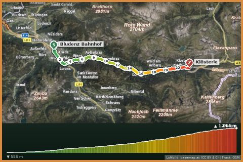
Klostertal cycle route (Route 4): Bludenz – Klösterle
Klösterle · Klostertal
Aerial imagery basemap.at (CC BY 4.0) · track OSM
Klostertal cycle route (Route 4): Bludenz – Klösterle
Klösterle · Klostertal
easy 👨👩👧 Family friendly
4 km of singletrail with 440 m of descent through forest and meadows from the Loischkopf plateau to the Tschengla – part of the Brandnertal trail network, 30 minutes from the house.
The Brandnertal has built a network of numbered singletrails (ST-…) around the Tschengla on the Bürserberg. The Alte Statt Trail ST-08 is one of the longer ones: it starts on the Alte Statt plateau below the Loischkopf at about 1,675 m – on the municipal boundary with Nenzing – and drops 440 m over 4 km to the Tschengla (1,236 m). OpenStreetMap grades it S2: roots, rocks, tight turns, but no jumps or built features – a classic natural trail.
Climb via the Tschengla forest roads to the Loischkopf or take the Einhornbahn II lift plus a stretch of gravel; if you want to ride several trails, the Tschengla also offers the Parpfienz Trail (ST-10) and other descents. The Tschengla is also the starting point for the stone circles and the Loischkopf loop – expect hikers at the crossings.
Drive to Bürserberg – Tschengla (car park). Climb the forest road towards Loischkopf/Alte Statt (approx. 450 m), trail entry signposted “ST-08 Alte Statt Trail”.
Riding skills S2 – protectors recommended. Wait a day after rain (root sections). Observe the Brandnertal trail rules; hikers have priority.
Landbus 580/581 from Bludenz to Bürserberg (Tschengla seasonally by hiking bus); from St. Gallenkirch with a change in Bludenz approx. 1 h.
Tschengla hikers' car park (mountain road from Bürs, fee in summer) and Loischkopf cable car car park.
Emergency: Alpine rescue 140 · Euro emergency 112 · Ambulance 144
All information without guarantee. Please check weather, opening hours and cable car operating times before setting off. Alpine tours require personal responsibility, suitable equipment and experience.
📚 Listed in: OpenStreetMap
Last updated: 13 Sep 2026 · Map data © OpenStreetMap contributors (ODbL)
Aerial imagery basemap.at (CC BY 4.0) · track OSM
Klostertal cycle route (Route 4): Bludenz – Klösterle
Klösterle · Klostertal
 Aerial imagery basemap.at (CC BY 4.0) · track OSM
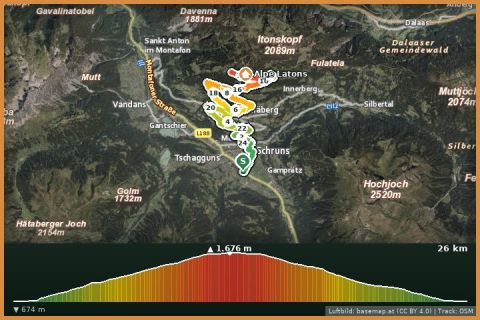
Jagdhütten Tour via Fritzensee
Tschagguns
Aerial imagery basemap.at (CC BY 4.0) · track OSM
Jagdhütten Tour via Fritzensee
Tschagguns
 Aerial imagery basemap.at (CC BY 4.0) · track OSM
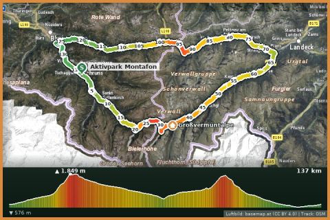
Silvretta-Arlberg-Runde
Tschagguns
Aerial imagery basemap.at (CC BY 4.0) · track OSM
Silvretta-Arlberg-Runde
Tschagguns