 Aerial imagery basemap.at (CC BY 4.0) · track OSM
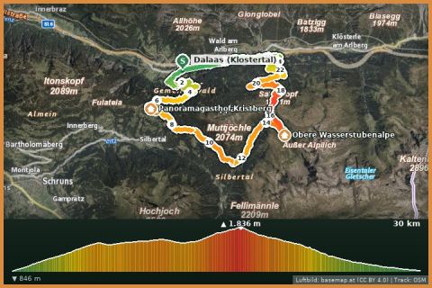
Kristberg – Sonnenkopf MTB loop (from Dalaas)
Dalaas · Klostertal
Aerial imagery basemap.at (CC BY 4.0) · track OSM
Kristberg – Sonnenkopf MTB loop (from Dalaas)
Dalaas · Klostertal
moderate
A small, fine Klostertal loop: 13 km and just under 500 m of climbing on the alp roads of the Nenzigast above Klösterle and Langen – with views of the Arlberg railway and the Roggelskopf walls.
The Nenzigast is an area of alps and old summer farms on the southern flank of the Klostertal between Klösterle and Langen am Arlberg. The loop, listed in OpenStreetMap as an official Vorarlberg bike tour, starts at the Großtobel gallery in Langen (1,130 m), climbs on forest and alp roads via the Milchweg above Klösterle to about 1,400 m and crosses back through forest and pastures to Danöfen and Langen. In total 13 km, a good 470 m of climbing, gravel and tarmac – an after-work or beginners' loop that still delivers real mountain scenery: the limestone walls of the Roggelskopf and Formaletsch opposite, the Arlberg railway line below.
Graded “intermediate” because the climb is steep in places; technically the loop is easy. From the holiday house it is a 35-minute drive to Langen – or combine the loop with the Sonnenkopf or the Stuben loop trail for a Klostertal day.
Park in Langen am Arlberg (station). Ride the loop anticlockwise: climb towards Klösterle, return via the Nenzigast alp roads to Danöfen.
Reachable car-free by Arlberg railway from Bludenz (bikes allowed). No refreshments on the loop – Klösterle and Langen have inns.
Landbus Montafon (lines 650/670/680) and Montafonerbahn Bludenz–Schruns; connections at vmobil.at.
Please check parking at the starting point on site (hiking car parks are usually signposted).
Emergency: Alpine rescue 140 · Euro emergency 112 · Ambulance 144
All information without guarantee. Please check weather, opening hours and cable car operating times before setting off. Alpine tours require personal responsibility, suitable equipment and experience.
📚 Listed in: OpenStreetMap
Last updated: 13 Sep 2026 · Map data © OpenStreetMap contributors (ODbL)
Aerial imagery basemap.at (CC BY 4.0) · track OSM
Kristberg – Sonnenkopf MTB loop (from Dalaas)
Dalaas · Klostertal
 Aerial imagery basemap.at (CC BY 4.0) · track OSM
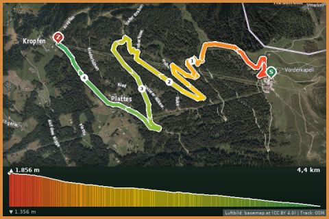
Trailpark Hochjoch – Hubertus Trail (blue, 4.1 km)
Silbertal
Aerial imagery basemap.at (CC BY 4.0) · track OSM
Trailpark Hochjoch – Hubertus Trail (blue, 4.1 km)
Silbertal
 Aerial imagery basemap.at (CC BY 4.0) · track OSM
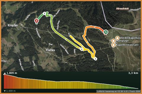
Trailpark Hochjoch – Kilka Wald Trail (red, 2.5 km)
Silbertal
Aerial imagery basemap.at (CC BY 4.0) · track OSM
Trailpark Hochjoch – Kilka Wald Trail (red, 2.5 km)
Silbertal