 Aerial imagery basemap.at (CC BY 4.0) · track OSM
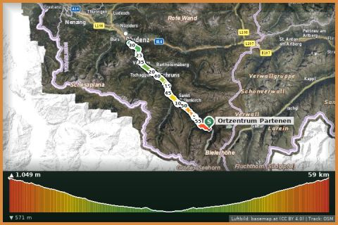
Durchs Montafon: from Partenen to Bludenz and retour
Partenen
Aerial imagery basemap.at (CC BY 4.0) · track OSM
Durchs Montafon: from Partenen to Bludenz and retour
Partenen
moderate 🎫 Card
3.7 km of flowing natural trail from the Heilbronner Hütte down to the Zeinisjoch: 270 m of descent at 2,000 m altitude – the highlight of the Verwall bike loops.
The trail starts right at the Neue Heilbronner Hütte at 2,320 m and follows the hut path north-east to the Zeinisjoch. The State of Tyrol lists it in its mountain bike database as a cross-country singletrail with 320 m of descent; in OpenStreetMap it is recorded as route 796. Over 3.7 km meadow paths alternate with a few stony sections and short technical bits; the descent mostly stays flowing and is a pleasure for experienced riders, while beginners will push on the steeper parts.
The trail is usually built into the big Verwall loops: from Partenen via Tafamunt and the Verbella climb to the Heilbronner Hütte (see “Neue Heilbronner Hütte Tour”), then down the trail to the Zeinisjoch and back to Partenen on the Zeinisjoch road. Hikers have priority on the path – it is also a section of the Zentralalpenweg 02A and the Min Weag.
Reach the hut from Partenen via the Tafamunt/Verbella road (climb approx. 1,300 m) or from the Zeinisjoch via the Zeinisjoch path. From the hut the trail is signposted as the path to the Zeinisjoch.
Helmet and protectors; slippery roots when wet. Refreshments at the Heilbronner Hütte before the descent. Do not race when hikers are out at weekends.
Landbus 650, stop Gaschurn Versettla cable car (approx. 10 min from St. Gallenkirch); ski bus in winter.
Large free car park at the Versettla cable car in Gaschurn (summer; paid in winter).
Emergency: Alpine rescue 140 · Euro emergency 112 · Ambulance 144
All information without guarantee. Please check weather, opening hours and cable car operating times before setting off. Alpine tours require personal responsibility, suitable equipment and experience.
📚 Listed in: OpenStreetMap
Last updated: 13 Sep 2026 · Map data © OpenStreetMap contributors (ODbL)
Aerial imagery basemap.at (CC BY 4.0) · track OSM
Durchs Montafon: from Partenen to Bludenz and retour
Partenen
 Aerial imagery basemap.at (CC BY 4.0) · track OSM
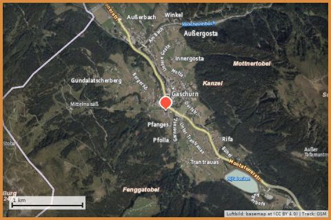
Intersport Versettla Valley
Gaschurn
Aerial imagery basemap.at (CC BY 4.0) · track OSM
Intersport Versettla Valley
Gaschurn
 Aerial imagery basemap.at (CC BY 4.0) · track OSM
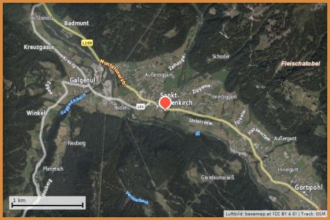
Sport Outlet Montafon Ortszentrum St. Gallenkirch
St. Gallenkirch
Aerial imagery basemap.at (CC BY 4.0) · track OSM
Sport Outlet Montafon Ortszentrum St. Gallenkirch
St. Gallenkirch