 Aerial imagery basemap.at (CC BY 4.0) · track OSM
Siedlungsgeschichteweg
Bartholomäberg
Aerial imagery basemap.at (CC BY 4.0) · track OSM
Siedlungsgeschichteweg
Bartholomäberg
moderate 👨👩👧 Family friendly 🎫 Card
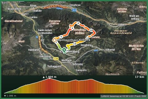
The Itonskopf (2,089 m) above Bartholomäberg – a long summit loop with views of three mountain ranges, ideal for the fit.
The Itonskopf is the striking peak above the Bartholomäberg and a first-class lookout mountain: Rätikon, Silvretta and Verwall fill the panorama, plus the whole Montafon. The summit trail starts in the village, climbs over alpine meadows and the ridge to the cross and returns as a loop – around 15.5 km, 1,100 m of ascent, 6 hours. Moderate but long; using the e-MTB variant saves the lower kilometres.
It is often windy at the top, but usually deserted – in contrast to the cable-car summits of the valley.
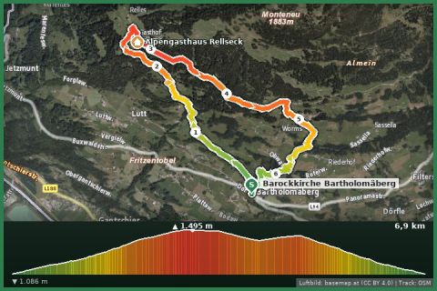
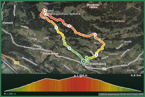
The route leads from Barockkirche Bartholomäberg via Rellseck and Fritzensee and back to the starting point.
The plotted track follows the marked trails according to OpenStreetMap; see the map, elevation profile and GPX file above. Please follow the signposting on site.
Regional rating: fitness 4/6, technique 2/6.
Start early – summer afternoons often bring thunderstorms. Carry enough water; many huts are only open from late June to late September.
From the holiday house in St. Gallenkirch the starting point is easy to reach by Landbus (stop 400 m away) or car – see the travel notes.
Landbus 680 Schruns–Silbertal to the Kristberg cable car valley station; hiking bus into the upper Silbertal (summer). From St. Gallenkirch via Schruns approx. 35 min.
Free car park at the Kristberg cable car in Silbertal.
Emergency: Alpine rescue 140 · Euro emergency 112 · Ambulance 144
All information without guarantee. Please check weather, opening hours and cable car operating times before setting off. Alpine tours require personal responsibility, suitable equipment and experience.
Last updated: 13 Sep 2026 · Map data © OpenStreetMap contributors (ODbL)
Aerial imagery basemap.at (CC BY 4.0) · track OSM
Siedlungsgeschichteweg
Bartholomäberg
 Aerial imagery basemap.at (CC BY 4.0) · track OSM
Rund um den Itonskopf
Montafon
Aerial imagery basemap.at (CC BY 4.0) · track OSM
Rund um den Itonskopf
Montafon
 Aerial imagery basemap.at (CC BY 4.0) · track OSM
Übers historische Bergwerk and Fritzensee to the Rellseck
Montafon
Aerial imagery basemap.at (CC BY 4.0) · track OSM
Übers historische Bergwerk and Fritzensee to the Rellseck
Montafon