 Aerial imagery basemap.at (CC BY 4.0) · track OSM
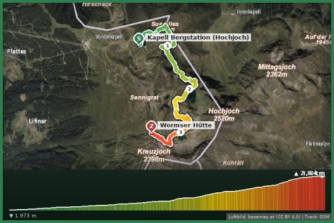
Seeweg lake trail: Kapell – Herzsee – Schwarzsee – Wormser Hütte
Schruns
Aerial imagery basemap.at (CC BY 4.0) · track OSM
Seeweg lake trail: Kapell – Herzsee – Schwarzsee – Wormser Hütte
Schruns
moderate 👨👩👧 Family friendly 🎫 Card
From the Hochjoch cable car through the 470 m ski tunnel up to the Wormser Hütte – the shortest way to 2,300 m.
The Hochjoch is Schruns’ home mountain, and the ski tunnel – at around 470 metres one of the longest in Europe – doubles as a hiking route in summer: it links the Kapell area with the Zamang basin below the Wormser Hütte. From Kapell (approx. 1,850 m) the path first climbs over ski slopes and alpine meadows, passes through the lit tunnel and then zigzags up to the Wormser Hütte (2,307 m), perched on a ledge high above the Montafon.
The hut is the starting point of the Wormser Höhenweg into the Verwall and of the Hochjoch via ferrata; the view stretches from the Rätikon across the Silvretta to the Arlberg. If you do not want to go all the way up, the Kapell area offers circular walks, a natural bathing lake and playgrounds. For the descent, the route through the Seetal (Kälbersee, Herzsee) back to the summit station is worthwhile.
Hochjoch cable car from Schruns to Kapell. Follow signs for “Wormser Hütte / Skitunnel”; through the tunnel and up the bends to the hut. Descend the same way or through the Seetal.
No head torch needed, but take a jacket for the tunnel (cool and draughty). The hut is staffed roughly from late June to early October.
Montafonerbahn to Schruns station (every 30 min from Bludenz), Hochjoch cable car a 5-minute walk; Landbus 650 from St. Gallenkirch approx. 15 min.
Parking at the Hochjoch cable car in Schruns is paid and limited; alternative free parking at the Zamang cable car.
Emergency: Alpine rescue 140 · Euro emergency 112 · Ambulance 144
All information without guarantee. Please check weather, opening hours and cable car operating times before setting off. Alpine tours require personal responsibility, suitable equipment and experience.
📚 Listed in: OpenStreetMap
Last updated: 13 Sep 2026 · Map data © OpenStreetMap contributors (ODbL)
Aerial imagery basemap.at (CC BY 4.0) · track OSM
Seeweg lake trail: Kapell – Herzsee – Schwarzsee – Wormser Hütte
Schruns
 Aerial imagery basemap.at (CC BY 4.0) · track OSM
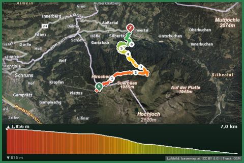
Alpwanderung Innerkapell
Silbertal
Aerial imagery basemap.at (CC BY 4.0) · track OSM
Alpwanderung Innerkapell
Silbertal
 Aerial imagery basemap.at (CC BY 4.0) · track OSM
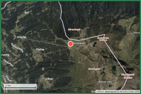
Naturkräftepfad Seebligasee
Silbertal
Aerial imagery basemap.at (CC BY 4.0) · track OSM
Naturkräftepfad Seebligasee
Silbertal