 Aerial imagery basemap.at (CC BY 4.0) · track OSM
Kristberg ski area
Silbertal
Aerial imagery basemap.at (CC BY 4.0) · track OSM
Kristberg ski area
Silbertal
👨👩👧 Family friendly ❄️ winter
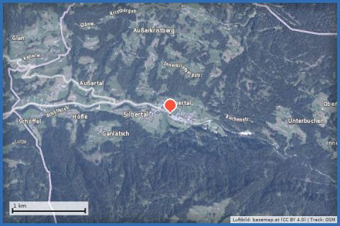
Gently downhill through the Silbertal: 5.6 km from the centre of Silbertal along the Litz to Schruns, 200 m of descent, return on bus 680.
The Silbertal is the Montafon's quiet side valley, named after the mining that goes back more than a thousand years here. This winter walk follows it down-valley: 5.6 km from the centre of Silbertal (889 m) down to Schruns (690 m), 211 m of descent and only 17 m of ascent, about an hour and a half. Via the Bargehrastraße you reach the Kapell Bahn valley station, then via the Höflestraße the old Silbertal road that follows the Litz – the 24 km river rising near the Fresch alp in the Verwall and flowing into the Ill at Schruns. The walk ends at the Kirchplatz in the centre of Schruns.
About half the route is recorded as cleared in the state's winter trail network; the rest runs along the quiet road. Refreshments in Silbertal and Schruns; before you set off, the Montafon mining museum in Silbertal is worth a visit. From our house take bus 650 to Schruns and bus 680 on to Silbertal (around 35 minutes) – and walk back to bus 650.
The plotted track follows the marked trails according to OpenStreetMap; see the map, elevation profile and GPX file above. Please follow the signposting on site.
Easy route, also for families; keep to the edge on the road sections. Packed snow can be slippery on the descent – spikes. Dogs on a lead. Bus 680 timetable at vmobil.at.
Landbus 680 Schruns–Silbertal to the Kristberg cable car valley station; hiking bus into the upper Silbertal (summer). From St. Gallenkirch via Schruns approx. 35 min.
Free car park at the Kristberg cable car in Silbertal.
Emergency: Alpine rescue 140 · Euro emergency 112 · Ambulance 144
All information without guarantee. Please check weather, opening hours and cable car operating times before setting off. Alpine tours require personal responsibility, suitable equipment and experience.
Last updated: 13 Sep 2026 · Map data © OpenStreetMap contributors (ODbL)
Aerial imagery basemap.at (CC BY 4.0) · track OSM
Kristberg ski area
Silbertal
 Aerial imagery basemap.at (CC BY 4.0) · track OSM
Silbertal via Stelzer to the Top station Kristbergbahn
Silbertal
Aerial imagery basemap.at (CC BY 4.0) · track OSM
Silbertal via Stelzer to the Top station Kristbergbahn
Silbertal
 Aerial imagery basemap.at (CC BY 4.0) · track OSM
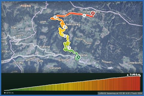
Silbertal to Kristberg
Silbertal
Aerial imagery basemap.at (CC BY 4.0) · track OSM
Silbertal to Kristberg
Silbertal