 Aerial imagery basemap.at (CC BY 4.0) · track OSM
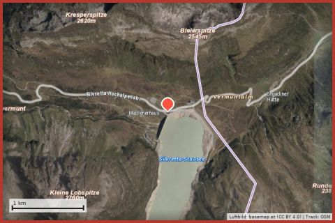
Silvrettasee Via Ferrata
Partenen
Aerial imagery basemap.at (CC BY 4.0) · track OSM
Silvrettasee Via Ferrata
Partenen
easy · A/B 👨👩👧 Family friendly
High-alpine summit via ferrata from the Saarbrücker Hütte: short but exposed at 2,783 m – pure Silvretta.
The Kleinlitzner stands directly above the Saarbrücker Hütte (2,538 m) in the heart of the Silvretta, and its via ferrata turns a hut stay into a summit tour: just under 200 m of ascent over gneiss slabs and blocks at grade C, exposed and at high altitude. The view from the summit of the Großlitzner, Seehorn and the glaciers is the reward – travel reports call the Saarbrücker Hütte one of the most beautiful hut locations in the Silvretta.
The hut itself is reached from the Bielerhöhe along the Vermunt reservoir in about 3 hours (the track is closed to cars). Plan an overnight stay for via ferrata plus approach and descent; weather changes come quickly up here.
The plotted track follows the marked trails according to OpenStreetMap; see the map, elevation profile and GPX file above. Please follow the signposting on site.
Regional rating: fitness 3/6, technique 3/6.
Start early – summer afternoons often bring thunderstorms. Carry enough water; many huts are only open from late June to late September.
From the holiday house in St. Gallenkirch the starting point is easy to reach by Landbus (stop 400 m away) or car – see the travel notes.
Landbus 650 to Partenen, then Vermunt cable car + tunnel bus to the Bielerhöhe (summer 2026: 20 June–4 Oct, uphill 8–12 and 13–16:30, last descent 17:00). Approx. 1 h in total from St. Gallenkirch.
Note: the Silvretta High Alpine Road is closed on the Vorarlberg side after rockfalls, expected until 2030 – car access only from Tyrol (Galtür). The Vermunt cable car car park in Partenen is closed in 2026 for construction; use alternative parking in Partenen village.
Emergency: Alpine rescue 140 · Euro emergency 112 · Ambulance 144
All information without guarantee. Please check weather, opening hours and cable car operating times before setting off. Alpine tours require personal responsibility, suitable equipment and experience.
Last updated: 13 Sep 2026 · Map data © OpenStreetMap contributors (ODbL)
Aerial imagery basemap.at (CC BY 4.0) · track OSM
Silvrettasee Via Ferrata
Partenen
 Aerial imagery basemap.at (CC BY 4.0) · track OSM
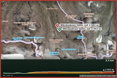
Practice via ferrata Wiesbadener Hut
Partenen
Aerial imagery basemap.at (CC BY 4.0) · track OSM
Practice via ferrata Wiesbadener Hut
Partenen
 Aerial imagery basemap.at (CC BY 4.0) · track OSM
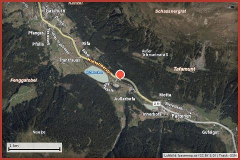
Via ferrata Rifa
Partenen
Aerial imagery basemap.at (CC BY 4.0) · track OSM
Via ferrata Rifa
Partenen