 Aerial imagery basemap.at (CC BY 4.0) · track OSM
Family via ferrata Partnunblick
Tschagguns
Aerial imagery basemap.at (CC BY 4.0) · track OSM
Family via ferrata Partnunblick
Tschagguns
easy · A/B 👨👩👧 Family friendly
The Rätikon classic: through limestone walls, gorge passages and along the ridge to the Sulzfluh (2,818 m) – long, alpine, unforgettable.
At 2,818 m the Sulzfluh is one of the great peaks of the Rätikon, and its via ferrata is regarded in international guides as the “classic” of the region. From the Tilisunahütte (2,211 m) the route climbs through gullies and over limestone slabs, traverses steep wall steps and finally reaches the ridge to the summit; the difficulty is C/D, plus alpine length and more than 900 m of ascent. From the top the view stretches from the Prättigau to the Silvretta glaciers.
The tour requires strength, stamina and solid via ferrata technique; in early summer snowfields often remain in the gullies. Most climbers stay overnight at the Tilisuna or Lindauer hut beforehand to be at the start early. Descend by the normal route back to the Tilisunahütte; around 6 hours in total.
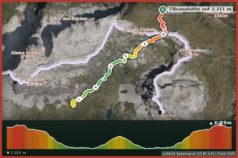
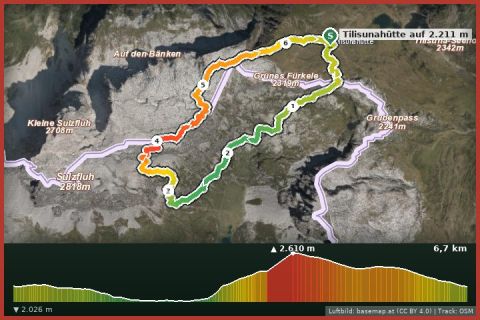
The plotted track follows the marked trails according to OpenStreetMap; see the map, elevation profile and GPX file above. Please follow the signposting on site.
Book the hut overnight. Helmet mandatory – rockfall from climbers ahead. Only in stable weather.
Montafonerbahn to Tschagguns or Landbus 650/651, stop Tschagguns Zelfen.
Parking in the centre of Tschagguns and at the Alpenbad Montafon.
Emergency: Alpine rescue 140 · Euro emergency 112 · Ambulance 144
All information without guarantee. Please check weather, opening hours and cable car operating times before setting off. Alpine tours require personal responsibility, suitable equipment and experience.
Last updated: 13 Sep 2026 · Map data © OpenStreetMap contributors (ODbL)
Aerial imagery basemap.at (CC BY 4.0) · track OSM
Family via ferrata Partnunblick
Tschagguns
 Aerial imagery basemap.at (CC BY 4.0) · track OSM
Partnunblick via ferrata
Tschagguns
Aerial imagery basemap.at (CC BY 4.0) · track OSM
Partnunblick via ferrata
Tschagguns
 Aerial imagery basemap.at (CC BY 4.0) · track OSM
Via ferrata Drusenfluh
Tschagguns
Aerial imagery basemap.at (CC BY 4.0) · track OSM
Via ferrata Drusenfluh
Tschagguns