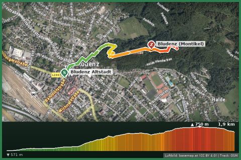
 Aerial imagery basemap.at (CC BY 4.0) · track OSM
Montikel panorama trail (Bludenz)
Bludenz · Vorarlberg
Aerial imagery basemap.at (CC BY 4.0) · track OSM
Montikel panorama trail (Bludenz)
Bludenz · Vorarlberg
easy 👨👩👧 Family friendly
37 km on the historic mule track over the Arlberg: from Bludenz (560 m) through Braz, Dalaas, Wald and Klösterle to Stuben and up to the pass – two to three stages, with the Arlberg railway always there for the way back.
The Arlbergweg follows the old trade route on which pack animals carried salt and wine between Lake Constance and Tyrol long before the Arlberg railway opened in 1884. The State of Vorarlberg lists it as a regional main route; the Tyrolean continuation reaches Landeck. The Vorarlberg part starts at Bludenz railway station, passes Gayenhofen castle and the old town and then climbs the Klostertal: Bings, Außer- and Innerbraz, Dalaas with the Klostertal museum, Wald am Arlberg, Klösterle with the parish church of the former Hospitaller hospice, Langen and finally Stuben (1,407 m). The last kilometres climb from the village to the Arlberg pass at 1,793 m, where Vorarlberg ends.
The tally: 37 km, about 1,550 m of ascent, mostly on hiking and forest tracks, partly on old paved sections, always within earshot of the Alfenz river. Typically two stages (Bludenz – Dalaas, approx. 17 km; Dalaas – Arlberg, approx. 20 km) or three easy days. Because the Arlberg railway runs parallel with stops in Braz, Dalaas, Hintergasse, Wald, Klösterle and Langen, every section can be walked on its own as a day hike. Line: trail network of the State of Vorarlberg (VoGIS, CC BY 4.0).
Start at Bludenz station (Montafonerbahn from Schruns). Signposted “Arlbergweg”; return from any railway stop in the Klostertal, from the Arlberg pass by bus to Langen or St. Anton.
The lower part (Bludenz–Dalaas) is snow-free in spring and late autumn too. The Klostertal museum in Wald am Arlberg (summer, Sundays) is worth a stop. It is often windy at the Arlberg pass – bring a windproof jacket.
Landbus Montafon (lines 650/670/680) and Montafonerbahn Bludenz–Schruns; connections at vmobil.at.
Please check parking at the starting point on site (hiking car parks are usually signposted).
Emergency: Alpine rescue 140 · Euro emergency 112 · Ambulance 144
All information without guarantee. Please check weather, opening hours and cable car operating times before setting off. Alpine tours require personal responsibility, suitable equipment and experience.
📚 Listed in: Vorarlberg hiking route network
Last updated: 13 Sep 2026 · Map data © OpenStreetMap contributors (ODbL) · Route line: trail network of the State of Vorarlberg (VoGIS, CC BY 4.0)
Aerial imagery basemap.at (CC BY 4.0) · track OSM
Montikel panorama trail (Bludenz)
Bludenz · Vorarlberg
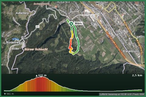 Aerial imagery basemap.at (CC BY 4.0) · track OSM
Rosenegg loop (Bürs)
Bürs · Vorarlberg
Aerial imagery basemap.at (CC BY 4.0) · track OSM
Rosenegg loop (Bürs)
Bürs · Vorarlberg
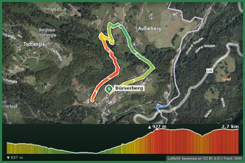 Aerial imagery basemap.at (CC BY 4.0) · track OSM
Masura loop (Bürserberg)
Bürserberg · Brandnertal
Aerial imagery basemap.at (CC BY 4.0) · track OSM
Masura loop (Bürserberg)
Bürserberg · Brandnertal