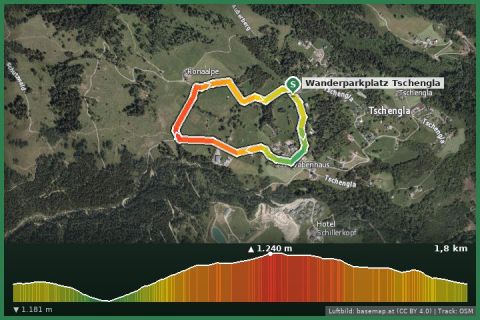
 Aerial imagery basemap.at (CC BY 4.0) · track OSM
Tschengla loop to the stone circles
Bürserberg · Brandnertal
Aerial imagery basemap.at (CC BY 4.0) · track OSM
Tschengla loop to the stone circles
Bürserberg · Brandnertal
easy 👨👩👧 Family friendly
13 km across the sunny slopes above Bludenz: orchards, chapels and old farmsteads between Nüziders, Rungelin, Gasünd and Außerbraz – a walk for spring and autumn.
“Sunnaweg” is Vorarlberg dialect for “sunny path” – and that is exactly what this local route of the state trail network is: it runs along the south-facing valley flank above Bludenz from Nüziders in the Walgau to Außerbraz at the entrance of the Klostertal. Over 13 km with about 650 m of ascent (500 m descent) it alternates between orchards, patches of woodland, small hamlets such as Rungelin and Gasünd and repeated viewpoints over the town, the confluence of the Ill and Alfenz rivers and across to the Rätikon.
The highest point, at just under 870 m, is only a little above the town, which makes the Sunnaweg one of the first snow-free trails in spring and one of the last in autumn – ideal when it is still winter up in the Montafon. If you do not want to walk the whole way, split it in Bludenz: the railway station is ten minutes below the path, and Nüziders and Braz also have stops on the Arlberg railway.
Take the train (Montafonerbahn/ÖBB) to Nüziders and follow the “Sunnaweg” signs uphill. The path stays at mid-slope and ends in Außerbraz near the Braz railway stop.
Very sunny and warm in summer – bring water. The orchards blossom in late April/early May. Refreshments in Bludenz (old town) halfway.
Landbus Montafon (lines 650/670/680) and Montafonerbahn Bludenz–Schruns; connections at vmobil.at.
Please check parking at the starting point on site (hiking car parks are usually signposted).
Emergency: Alpine rescue 140 · Euro emergency 112 · Ambulance 144
All information without guarantee. Please check weather, opening hours and cable car operating times before setting off. Alpine tours require personal responsibility, suitable equipment and experience.
📚 Listed in: Vorarlberg hiking route network
Last updated: 13 Sep 2026 · Map data © OpenStreetMap contributors (ODbL) · Route line: trail network of the State of Vorarlberg (VoGIS, CC BY 4.0)
Aerial imagery basemap.at (CC BY 4.0) · track OSM
Tschengla loop to the stone circles
Bürserberg · Brandnertal
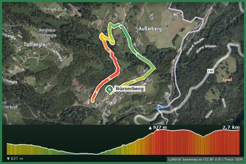 Aerial imagery basemap.at (CC BY 4.0) · track OSM
Masura loop (Bürserberg)
Bürserberg · Brandnertal
Aerial imagery basemap.at (CC BY 4.0) · track OSM
Masura loop (Bürserberg)
Bürserberg · Brandnertal
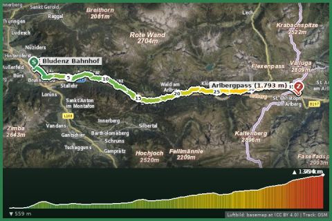 Aerial imagery basemap.at (CC BY 4.0) · track OSM
Arlbergweg: from Bludenz through the Klostertal to the Arlberg pass
Klösterle · Klostertal
Aerial imagery basemap.at (CC BY 4.0) · track OSM
Arlbergweg: from Bludenz through the Klostertal to the Arlberg pass
Klösterle · Klostertal