 Aerial imagery basemap.at (CC BY 4.0) · track OSM
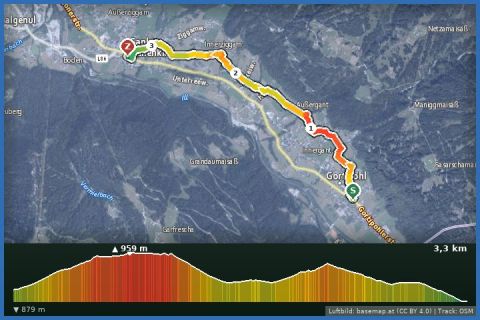
From Gortipohl via Innergant and Innerziggam to St. Gallenkirch
Montafon
Aerial imagery basemap.at (CC BY 4.0) · track OSM
From Gortipohl via Innergant and Innerziggam to St. Gallenkirch
Montafon
easy 👨👩👧 Family friendly ❄️ winter
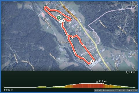
Short village loop from Gortipohl via the Mällaweg: 2.9 km, 40 m of ascent, an hour through woods and meadows – three minutes from our house.
The small loop is the relaxed version of the Gortipohl loop: from the centre of Gortipohl (950 m) it follows the Blendolmaweg, Mällaweg, Sponaweg and Allmeinweg once around the district – past the tennis court, through a short stretch of snowy forest and across the open meadows with views of the far side of the valley. 2.92 km, 40 m of ascent, about an hour at an easy pace. According to the provincial trail data the paths are mostly groomed, in places cleared, and almost entirely level.
From our house it is three minutes by car or a short walk to the start; Gortipohl is served by Landbus lines 650 and 670 (Gortipohl Zentrum stop), and parking is best in St. Gallenkirch. Refreshments are available in the village inns. For families with small children, for a stroll after a meal or as a short loop while it is snowing this is just right; if you want more, continue with the big Gortipohl loop or the village walk to Gaschurn afterwards.
The plotted track follows the marked trails according to OpenStreetMap; see the map, elevation profile and GPX file above. Please follow the signposting on site.
Also fine with a pushchair with large wheels and with a dog. Sturdy shoes; the forest section can be slippery. After fresh snow the path is not always groomed straight away.
Landbus Montafon (lines 650/670/680) and Montafonerbahn Bludenz–Schruns; connections at vmobil.at.
Please check parking at the starting point on site (hiking car parks are usually signposted).
Emergency: Alpine rescue 140 · Euro emergency 112 · Ambulance 144
All information without guarantee. Please check weather, opening hours and cable car operating times before setting off. Alpine tours require personal responsibility, suitable equipment and experience.
Last updated: 13 Sep 2026 · Map data © OpenStreetMap contributors (ODbL)
Aerial imagery basemap.at (CC BY 4.0) · track OSM
From Gortipohl via Innergant and Innerziggam to St. Gallenkirch
Montafon
 Aerial imagery basemap.at (CC BY 4.0) · track OSM
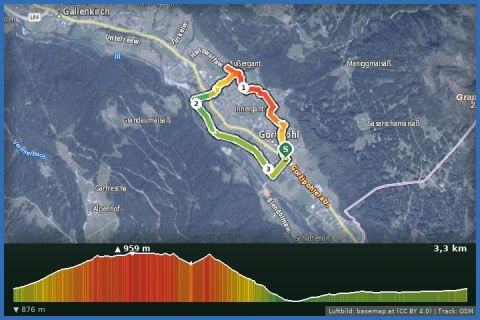
Gortipohl Loop
Montafon
Aerial imagery basemap.at (CC BY 4.0) · track OSM
Gortipohl Loop
Montafon
 Aerial imagery basemap.at (CC BY 4.0) · track OSM
No. 19: Large Gortipohl loop (classic)
Montafon
Aerial imagery basemap.at (CC BY 4.0) · track OSM
No. 19: Large Gortipohl loop (classic)
Montafon