 Aerial imagery basemap.at (CC BY 4.0) · track OSM
Gargellner Fenster Schneeschuhwanderweg
Gargellen
Aerial imagery basemap.at (CC BY 4.0) · track OSM
Gargellner Fenster Schneeschuhwanderweg
Gargellen
moderate ❄️ winter
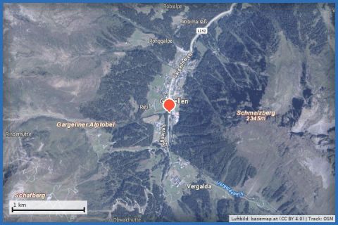
Short high-level loop on the Schafberg plateau above Gargellen: 1.5 km at around 2,100 m, the Schafberg Hüsli on the way and the Madrisa right in front of you.
The Schafbergbahn takes you from Gargellen (1,423 m, the highest village in the Montafon) up to the Schafberg plateau at around 2,130 m in a little over six minutes. That is where this short winter walk starts: 1.5 km with 116 m of ascent, taking about 45 minutes. The marked trail leads from the Schafberg Hüsli mountain restaurant at the top station to the top of the Valzifenz drag lift and on to the bottom station of the Kristallbahn, makes a small loop there and returns the same way. All around you stand the peaks of the Rätikon, with the Madrisa (2,770 m) to the south, plus the Ritzenspitzen, Valiseraspitze and Rütihorn – a panorama the trail delivers with very little effort.
The trail lies in the middle of the ski area and is laid out by the cable car company, not by the state of Vorarlberg, so it can only be walked while the lifts are running (winter operating dates according to the operator; pedestrian ticket for ascent and descent at the ticket office). Refreshments at the Schafberg Hüsli right at the top station. From our house in St. Gallenkirch, bus 670 takes you to the Gargellen valley station in about 20 minutes; by car it is around 12 km.
The plotted track follows the marked trails according to OpenStreetMap; see the map, elevation profile and GPX file above. Please follow the signposting on site.
At over 2,000 m it is noticeably colder and windier than in the valley – dress warmly, wear sturdy boots and take spikes for icy sections. After fresh snow, grooming may take a while; check the avalanche bulletin (lawine-vorarlberg.at) and the weather beforehand. Mind the time of the last descent.
Landbus Montafon (lines 650/670/680) and Montafonerbahn Bludenz–Schruns; connections at vmobil.at.
Please check parking at the starting point on site (hiking car parks are usually signposted).
Emergency: Alpine rescue 140 · Euro emergency 112 · Ambulance 144
All information without guarantee. Please check weather, opening hours and cable car operating times before setting off. Alpine tours require personal responsibility, suitable equipment and experience.
Last updated: 13 Sep 2026 · Map data © OpenStreetMap contributors (ODbL)
Aerial imagery basemap.at (CC BY 4.0) · track OSM
Gargellner Fenster Schneeschuhwanderweg
Gargellen
 Aerial imagery basemap.at (CC BY 4.0) · track OSM
Along the Suggadin Stream to Borstboden (Gargellen)
Gargellen
Aerial imagery basemap.at (CC BY 4.0) · track OSM
Along the Suggadin Stream to Borstboden (Gargellen)
Gargellen
 Aerial imagery basemap.at (CC BY 4.0) · track OSM
Gargellen ski area
Gargellen
Aerial imagery basemap.at (CC BY 4.0) · track OSM
Gargellen ski area
Gargellen