 Aerial imagery basemap.at (CC BY 4.0) · track OSM
Wildried high-level route
Silbertal
Aerial imagery basemap.at (CC BY 4.0) · track OSM
Wildried high-level route
Silbertal
easy 🎫 Card
Panoramic loop on the Kristberg between 1,393 and 1,588 m: 5.5 km via the miners' path, Kristbergsattel and the Ganzaleita viewpoint – ideal for altitude training.
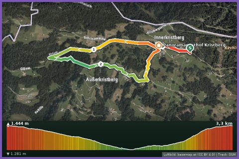
The Fulateia Loop is the medium-length route in the Kristberg running network: 5.5 km, 229 m of ascent, two climbs, all between 1,393 and 1,588 m – an altitude at which training becomes noticeably more effective. From the Kristbergbahn top station it follows the miners' path to the Kristbergsattel, the saddle between the Silbertal and Bartholomäberg where ore was once mined, on to the forest school and up to the Ganzaleita viewpoint. There the view opens over the whole Montafon to the Rätikon and Silvretta. Via Fulateia and Maschleu you pass the Kappusee to the Panoramagasthof Kristberg and return to the top station. Underfoot: path, gravel and tarmac; the 1 hour 5 minutes in our fact box is a guide value for hikers, runners need about half.
The loop is well signposted – the running-network boards show direction, distance and difficulty – and combines nicely with the short Bodastall Loop or the big Kristberg Lakes Loop. Refreshments at the Panoramagasthof, water at the top station. The Kristbergbahn runs in summer 2026 from 1 May to 1 November and is included in the Freizeit-WildPass; from our house it is 21 minutes to the valley station in Silbertal (bus 680 from Schruns) or 29 minutes by car up the Kristbergstraße.
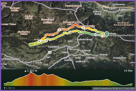
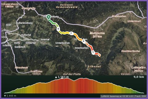
The plotted track follows the marked trails according to OpenStreetMap; see the map, elevation profile and GPX file above. Please follow the signposting on site.
At 1,500 m it cools down quickly – a light windproof belongs in your running pack even in sunshine. Check the Kristbergbahn's last descent before you set off.
Landbus 680 Schruns–Silbertal to the Kristberg cable car valley station; hiking bus into the upper Silbertal (summer). From St. Gallenkirch via Schruns approx. 35 min.
Free car park at the Kristberg cable car in Silbertal.
Last updated: 13 Sep 2026 · Map data © OpenStreetMap contributors (ODbL)