 Aerial imagery basemap.at (CC BY 4.0) · track OSM
Partenen village loop
Partenen
Aerial imagery basemap.at (CC BY 4.0) · track OSM
Partenen village loop
Partenen
easy 🎫 Card
Easy forest loop at the entrance to Partenen: 6.0 km and 134 m of ascent from the Vermuntwerk around the Rifa basin and back through Trantrauas and the Harzawald.
The Harzawald Trail is the easy loop at the very end of the Montafon: 6.0 km with only 134 m of ascent between 983 and 1,116 m, starting and finishing at the Vermunt power station by the Vermuntbahn valley station in Partenen. From there the route runs along the Rifa basin – the balancing reservoir Illwerke uses for its chain of power stations, whose surface mirrors the mountains on still mornings – climbs gently into the hillside forest of Trantrauas and returns through the Harzawald to the basin. The surface is mostly forest and meadow track with no technical sections; the 1 hour 5 minutes in our fact box is a guide value for walkers, at running pace the loop takes a good half hour. Above the treetops you see the Vallüla and the peaks at the head of the valley – Partenen lies where the Montafon ends and the Silvretta begins.
The loop works well as an easy run before or after an excursion: from the Vermuntbahn, cable car and tunnel bus take you to the Bielerhöhe (summer 2026: 20 June to 4 October), and the Europatreppe 4000 starts right next door. Partenen is 10 minutes by car from our house, and bus 650 stops in the village. Water and refreshments are available in Partenen.
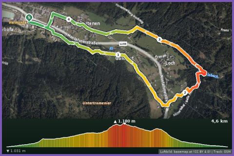
The route leads from Vermuntkraftwerk via Vermuntbahn and Ausgleichsbecken Rifa and back to the starting point.
The plotted track follows the marked trails according to OpenStreetMap; see the map, elevation profile and GPX file above. Please follow the signposting on site.
The Vermuntbahn car park is closed in 2026 for construction work – use the alternative car parks in Partenen village. Also suitable for beginners and families with children who run.
Landbus 650 to Partenen, then Vermunt cable car + tunnel bus to the Bielerhöhe (summer 2026: 20 June–4 Oct, uphill 8–12 and 13–16:30, last descent 17:00). Approx. 1 h in total from St. Gallenkirch.
Note: the Silvretta High Alpine Road is closed on the Vorarlberg side after rockfalls, expected until 2030 – car access only from Tyrol (Galtür). The Vermunt cable car car park in Partenen is closed in 2026 for construction; use alternative parking in Partenen village.
Last updated: 13 Sep 2026 · Map data © OpenStreetMap contributors (ODbL)