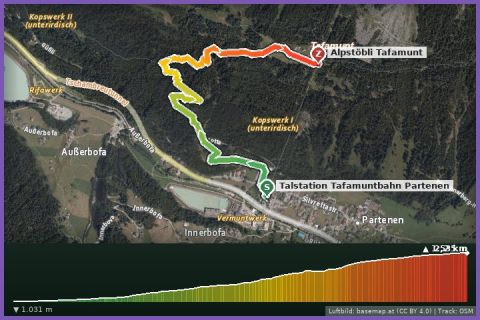
 Aerial imagery basemap.at (CC BY 4.0) · track OSM
Montafoner Berglauf – race course
Partenen
Aerial imagery basemap.at (CC BY 4.0) · track OSM
Montafoner Berglauf – race course
Partenen
difficult 🎫 Card
Around the Kops reservoir at 1,810 m on the Tyrolean border: 4.6 km of almost level shoreline path with views of dam and Silvretta – by car currently only via Galtür.
The Kopssee is an Illwerke storage reservoir between the Verwall and Silvretta ranges, just below the Zeinisjoch pass (1,842 m) on the border between Vorarlberg and Tyrol. It was built from 1962 to 1969; the 122 m high arch dam holds back 42.9 million cubic metres of water, partly brought in through some 33 km of tunnels from Tyrolean streams, which drives the Kops I and II power stations in Partenen. The Kopssee Loop follows the shoreline path once around the lake: 4.6 km, 48 m of ascent, between 1,811 and 1,834 m – a high-altitude run without climbs on gravel and meadow tracks, with the dam, the Silvretta peaks and the Zeinisjoch as backdrop. The 49 minutes in our fact box is a guide value for walkers; Dutch travel blogs rank the lake among the most beautiful reservoirs in Vorarlberg. Refreshments are available at the Zeinisjoch.
Getting there is currently the real challenge: the Silvretta High Alpine Road is closed on the Vorarlberg side until around 2030, so by car the lake is reached only from Galtür (Tyrol) over the Zeinisjoch – about two hours from our house via the Arlberg and the Paznaun valley. On foot you take the Tafamuntbahn from Partenen (summer 2026: 4 June to 18 October) and then hike via the Wiegensee and the Verbellaalpe to the Kopssee, a mountain walk of several hours through the Verwall Natura 2000 area.
The plotted track follows the marked trails according to OpenStreetMap; see the map, elevation profile and GPX file above. Please follow the signposting on site.
Above 1,800 m the weather changes fast – pack a windproof and hat even in summer. If you come on foot from Tafamunt, plan the return around the Tafamuntbahn's last descent.
Landbus Montafon (lines 650/670/680) and Montafonerbahn Bludenz–Schruns; connections at vmobil.at.
Please check parking at the starting point on site (hiking car parks are usually signposted).
Last updated: 17 Sep 2026 · Map data © OpenStreetMap contributors (ODbL)
Aerial imagery basemap.at (CC BY 4.0) · track OSM
Montafoner Berglauf – race course
Partenen
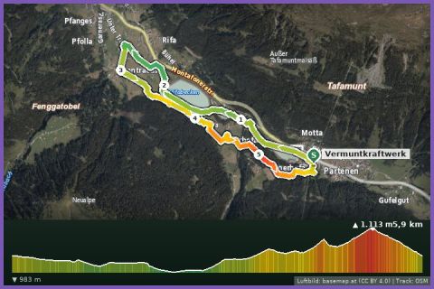 Aerial imagery basemap.at (CC BY 4.0) · track OSM
Harzawald Trail Partenen
Partenen/Bielerhöhe
Aerial imagery basemap.at (CC BY 4.0) · track OSM
Harzawald Trail Partenen
Partenen/Bielerhöhe
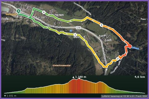 Aerial imagery basemap.at (CC BY 4.0) · track OSM
Partenen village loop
Partenen
Aerial imagery basemap.at (CC BY 4.0) · track OSM
Partenen village loop
Partenen