 Aerial imagery basemap.at (CC BY 4.0) · track OSM
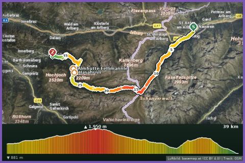
Montafon Arlberg Marathon 42 km – Start: St. Anton am Arlberg
Montafon · Vorarlberg
Aerial imagery basemap.at (CC BY 4.0) · track OSM
Montafon Arlberg Marathon 42 km – Start: St. Anton am Arlberg
Montafon · Vorarlberg
difficult
The St. Anton version of the Panorama Trail: 14.8 km and 450 m of ascent from the Dorfstraße to the Verwallsee, back via the Sattelwaldweg and the Moosbach.
Since 2003 the Montafon Arlberg Marathon has linked St. Anton am Arlberg in Tyrol with Silbertal in the Montafon; the Panorama Trail is its entry-level distance and was held on the Tyrolean side in 2026. Start and finish are in the pedestrianised Dorfstraße of St. Anton (1,284 m). The loop heads into the Verwall valley to the Verwallsee, the small reservoir below the Patteriol (3,065 m), climbs via the Sattelwaldweg to the highest point at 1,614 m and returns to the village via the Moosbach and the cemetery. According to the track 14.8 km and 450 m of ascent, guideline 3 hours walking time. Surface: forest and hiking tracks in the woods, asphalt by the lake and in the village.
For guests at our holiday house this is an excursion to the other side of the Arlberg: 59 km, a good hour by car over the Arlberg pass or through the Arlberg tunnel, or more sustainably by Montafonerbahn and ÖBB via Bludenz to St. Anton. It combines well with the Verwall path around the lake or a stroll through the village; there are plenty of places to eat at the Verwallsee and in St. Anton.
The plotted track follows the marked trails according to OpenStreetMap; see the map, elevation profile and GPX file above. Please follow the signposting on site.
Parking in St. Anton is charged; arriving by train is more relaxed. The Verwall path is popular with walkers and bikers – be considerate. For runners staying in the Montafon a good day out to get to know the marathon course at its starting town.
Landbus Montafon (lines 650/670/680) and Montafonerbahn Bludenz–Schruns; connections at vmobil.at.
Please check parking at the starting point on site (hiking car parks are usually signposted).
Last updated: 13 Sep 2026 · Map data © OpenStreetMap contributors (ODbL)
Aerial imagery basemap.at (CC BY 4.0) · track OSM
Montafon Arlberg Marathon 42 km – Start: St. Anton am Arlberg
Montafon · Vorarlberg
 Aerial imagery basemap.at (CC BY 4.0) · track OSM
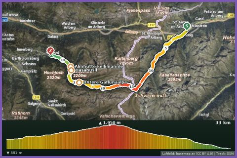
T33 Trail 33 km (Montafon Arlberg Marathon St. Anton at the Arlberg)
St. Anton / Silbertal · Vorarlberg
Aerial imagery basemap.at (CC BY 4.0) · track OSM
T33 Trail 33 km (Montafon Arlberg Marathon St. Anton at the Arlberg)
St. Anton / Silbertal · Vorarlberg
 Aerial imagery basemap.at (CC BY 4.0) · track OSM
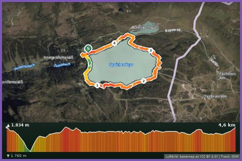
Kopssee Loop
Montafon
Aerial imagery basemap.at (CC BY 4.0) · track OSM
Kopssee Loop
Montafon