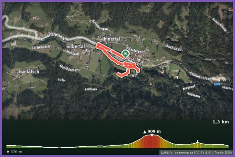
 Aerial imagery basemap.at (CC BY 4.0) · track OSM
Kids' Trail (Montafon Arlberg Marathon Silbertal)
Silbertal
Aerial imagery basemap.at (CC BY 4.0) · track OSM
Kids' Trail (Montafon Arlberg Marathon Silbertal)
Silbertal
easy 👨👩👧 Family friendly
The T33 in its classic direction: 33.8 km from the Silbertal fire station through the Gafluna valley over the Winterjöchle to St. Anton – 1,150 m of ascent.
Until 2018 the Montafon Arlberg Marathon started in Silbertal and finished in St. Anton am Arlberg – this route is the T33 in exactly that classic direction. From the Silbertal fire station (883 m) you run past the Kristbergbahn valley station to the Teufelsbach waterfall and the Fellimännle inn, then up through the quiet Gafluna valley to the Untere Gafluna alp and the Fresch alp. The climb to the Silbertaler Winterjöchle (highest point according to the track around 1,950 m) is the highlight: a narrow mountain path with views of the Langsee. After that the route drops through the Schönverwall to the Verwallsee and on broad tracks into St. Anton (Dorfstraße, 1,297 m). According to the track 33.8 km, 1,150 m of ascent and 736 m of descent; guideline 6 hours walking time.
Compared with today's race direction this version is the harder one, because most of the vertical metres are run uphill – but you start almost on our doorstep: buses 650 and 680 via Schruns take about 35 minutes to Silbertal, by car it is 16 km. From St. Anton you return by ÖBB train to Bludenz and the Montafonerbahn to Schruns. Both directions are in our database; the current race has run from St. Anton to Silbertal since 2019.
The route leads from Feuerwehrhaus Silbertal via Talstation Montafoner Kristbergbahn.
The plotted track follows the marked trails according to OpenStreetMap; see the map, elevation profile and GPX file above. Please follow the signposting on site.
Start early so that you are over the Winterjöchle before the afternoon thunderstorms. After the Fellimännle there is no refreshment stop until the Verwallsee – carry water and bars for around 20 km. Sure-footedness is needed on the path to the Jöchle; poles recommended.
Landbus 680 Schruns–Silbertal to the Kristberg cable car valley station; hiking bus into the upper Silbertal (summer). From St. Gallenkirch via Schruns approx. 35 min.
Free car park at the Kristberg cable car in Silbertal.
Last updated: 13 Sep 2026 · Map data © OpenStreetMap contributors (ODbL)
Aerial imagery basemap.at (CC BY 4.0) · track OSM
Kids' Trail (Montafon Arlberg Marathon Silbertal)
Silbertal
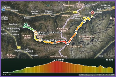 Aerial imagery basemap.at (CC BY 4.0) · track OSM
Montafon Arlberg Marathon 42 km – Start: Silbertal
Silbertal
Aerial imagery basemap.at (CC BY 4.0) · track OSM
Montafon Arlberg Marathon 42 km – Start: Silbertal
Silbertal
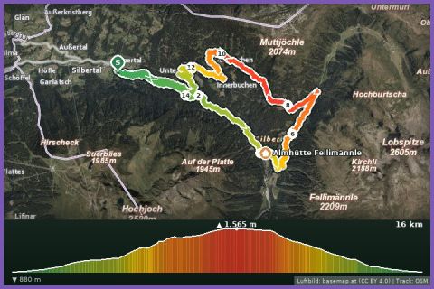 Aerial imagery basemap.at (CC BY 4.0) · track OSM
Panoramatrail 17 km (Montafon Arlberg Marathon Silbertal)
Silbertal
Aerial imagery basemap.at (CC BY 4.0) · track OSM
Panoramatrail 17 km (Montafon Arlberg Marathon Silbertal)
Silbertal