 Aerial imagery basemap.at (CC BY 4.0) · track OSM
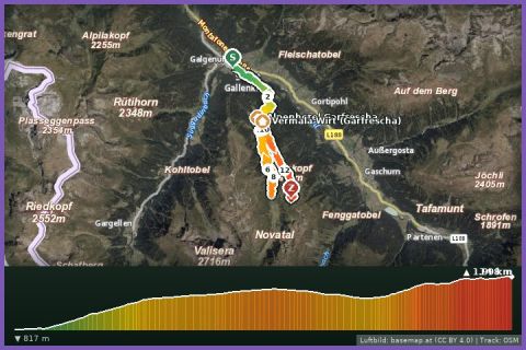
Montafon Totale Trail 16: 16 km, 1,450 m of ascent
St. Gallenkirch
Aerial imagery basemap.at (CC BY 4.0) · track OSM
Montafon Totale Trail 16: 16 km, 1,450 m of ascent
St. Gallenkirch
difficult 🎫 Card
8.7 km high-level loop from Garfrescha over the Gantakopf (1,958 m) towards Nova Stoba and back – 517 m of ascent; the Garfrescha cable car is 600 m from our house.
The Gantakopf trail run is our home loop at altitude: the Garfrescha cable car is 600 m from our holiday house and takes you in a few minutes up to the Garfrescha Maisäß settlement (1,478 m), where the route begins at the Brunellawirt mountain inn. From the Maisäß the path first climbs steeply through the forest, then over a broad ridge to the Gantakopf (1,958 m), the viewpoint between Garfrescha and Nova Stoba with views of the Verwall, Silvretta and Rätikon. It continues on the panorama path to just below Nova Stoba (highest point according to the track 1,995 m), then returns to Garfrescha on a second path across the alpine meadows. According to the track 8.7 km and 517 m of ascent, guideline 2 hours 5 minutes walking time.
Refreshments at the start at the Brunellawirt and at the top at Nova Stoba; in between there is neither water nor shade. The loop combines in many ways: from Nova Stoba with the Madrisella trail run, or after the loop you run the hiking trail from Garfrescha down to Gortipohl (around 500 vertical metres) and save the ride down. Garfrescha cable car summer 2026: 27 June to 4 October, included in the Freizeit-WildPass.
The route leads via Brunellawirt and back to the starting point.
The plotted track follows the marked trails according to OpenStreetMap; see the map, elevation profile and GPX file above. Please follow the signposting on site.
The panorama path is a popular hiking trail – walkers have priority, especially on the narrow sections along the ridge. At almost 2,000 m pack a wind and rain jacket; thunderstorms build quickly in the afternoon. Pass grazing cattle at a distance.
Landbus Montafon (lines 650/670/680) and Montafonerbahn Bludenz–Schruns; connections at vmobil.at.
Please check parking at the starting point on site (hiking car parks are usually signposted).
Last updated: 13 Sep 2026 · Map data © OpenStreetMap contributors (ODbL)
Aerial imagery basemap.at (CC BY 4.0) · track OSM
Montafon Totale Trail 16: 16 km, 1,450 m of ascent
St. Gallenkirch
 Aerial imagery basemap.at (CC BY 4.0) · track OSM
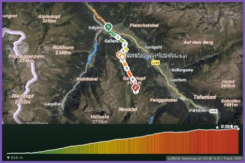
Montafon Totale Mountain Run 10: 10 km, 1,200 m of ascent
St. Gallenkirch
Aerial imagery basemap.at (CC BY 4.0) · track OSM
Montafon Totale Mountain Run 10: 10 km, 1,200 m of ascent
St. Gallenkirch
 Aerial imagery basemap.at (CC BY 4.0) · track OSM
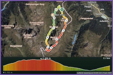
Trail run Madrisella
Montafon
Aerial imagery basemap.at (CC BY 4.0) · track OSM
Trail run Madrisella
Montafon