 Aerial imagery basemap.at (CC BY 4.0) · track OSM
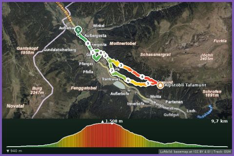
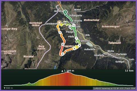
Ganeu Maisäß Loop
Gaschurn
Aerial imagery basemap.at (CC BY 4.0) · track OSM
Ganeu Maisäß Loop
Gaschurn
difficult
Summit run from Nova Stoba: 10.9 km and 824 m of ascent over the Versettla (2,372 m) and Madrisella (2,466 m), down to Alpe Nova and back to the top station.
The Madrisella trail run is the high-alpine classic of the Silvretta Montafon. Start and finish is the top station of the Versettla cable car at the Nova Stoba mountain restaurant (2,005 m). The path climbs along the ridge to the Versettla (2,372 m) – a wooden tripod marks the summit – and on to the Madrisella (2,466 m), the highest point of the loop with views into the Silvretta, across to the Madrisa and into the Rätikon. The descent follows flowing paths down into the Nova valley to Alpe Nova (1,730 m) and past the Serres lake before the final 270 vertical metres or so back up to Nova Stoba. According to the track 10.9 km and 824 m of ascent, guideline 2 hours 50 minutes walking time; the surface is alpine mountain paths with boulders on the ridge and alp tracks in the valley.
Up and down you go with the Versettla cable car from Gaschurn (summer 2026: 19 June to 4 October, included in the Freizeit-WildPass); if you want to run all the vertical metres, combine it with the Nova Stoba Climb or with the loop over the Gantakopf to Garfrescha and on down to us in Gortipohl. Refreshments at Nova Stoba and at Alpe Nova. From our house it is 4 km to the valley station, around 10 minutes on bus 650.
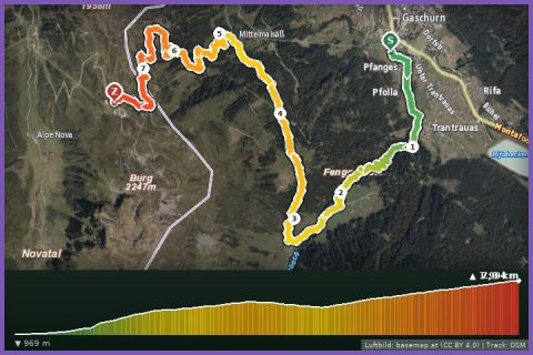
The route leads via Bergrestaurant Nova Stoba, Bergstation Versettla Bahn, Vier Barga, L19: Nova Stoba, Bergstation Versettla Bahn, Gaschurn, Gantakopf (1.958 m) and Seressee im Novatal, Gaschurn and back to the starting point.
The plotted track follows the marked trails according to OpenStreetMap; see the map, elevation profile and GPX file above. Please follow the signposting on site.
High alpine: sure-footedness on the ridge, poles for the descent, wind and rain jacket, hat – at 2,400 m it is cool even in July. Start only in settled weather and check the snow situation in early summer. Walkers on the ridge path have priority.
Landbus Montafon (lines 650/670/680) and Montafonerbahn Bludenz–Schruns; connections at vmobil.at.
Please check parking at the starting point on site (hiking car parks are usually signposted).
Last updated: 13 Sep 2026 · Map data © OpenStreetMap contributors (ODbL)