 Aerial imagery basemap.at (CC BY 4.0) · track OSM
Three Alps Loop Gargellen
Gargellen
Aerial imagery basemap.at (CC BY 4.0) · track OSM
Three Alps Loop Gargellen
Gargellen
difficult
4.7 km running loop into the Valzifenz valley: from the Gargellen cable cars via Vergalda to the Madrisahütte and back past the Hochmontafon holiday park – 249 m of ascent.
South of Gargellen two valleys open up: the Vergalda valley and the Valzifenz valley, which leads to the Schlappiner Joch and the Swiss border. The Valzifenz run dips into both. From the cable car car park (1,430 m) you run up the valley to Vergalda, climb on to the Madrisahütte and reach the highest point at 1,652 m; the loop then drops through the Valzifenz valley past the Hochmontafon holiday park back into the village. According to the track 4.7 km and 249 m of ascent, guideline 57 minutes walking time – a good half hour when run. Surface: alp tracks and hiking paths, short asphalt sections in the village; the Madrisa (2,770 m) looks over your shoulder the whole way.
The loop is the right choice for a short hill run on arrival day or as a supplement to the Suggadin Tour and the Vergalda loop; to collect vertical metres, add the Schafberg run up to the Schafberg Hüsli at the top. A familiar sight for our Dutch guests: the Hochmontafon holiday park belongs to Landal. Refreshments in Gargellen; from our house bus 670 runs hourly and takes around 20 minutes to the Schafbergbahn stop, by car it is 10 km.
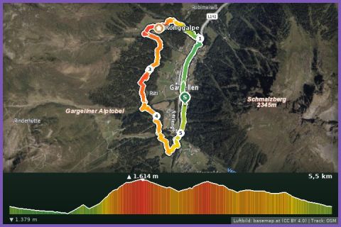
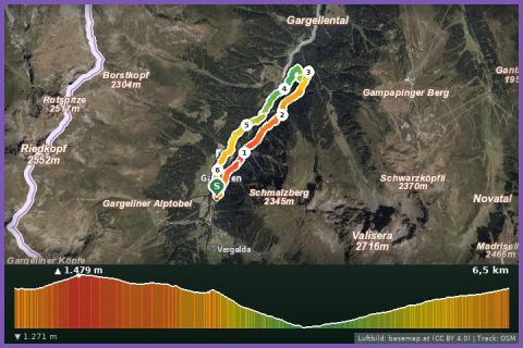
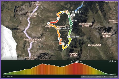
The plotted track follows the marked trails according to OpenStreetMap; see the map, elevation profile and GPX file above. Please follow the signposting on site.
Free, no lift ticket needed. The alp tracks can be managed with a sturdy running buggy, the paths cannot. Grazing cattle and gates along the way; in rain wear trail shoes with grip.
Landbus 670 Schruns–St. Gallenkirch–Gargellen (hourly), stop Gargellen Schafberg cable car; approx. 20 min from St. Gallenkirch.
Free parking at the Schafberg cable car in Gargellen and at the end of the village (Vergalden).
Last updated: 13 Sep 2026 · Map data © OpenStreetMap contributors (ODbL)