 Aerial imagery basemap.at (CC BY 4.0) · track OSM
Teufelsbach waterfall loop
Silbertal
Aerial imagery basemap.at (CC BY 4.0) · track OSM
Teufelsbach waterfall loop
Silbertal
easy 👨👩👧 Family friendly 🎫 Card
12.2 km and 697 m of ascent from Silbertal via the Teufelsbach waterfall, Fellimännle and the Wasserstuben valley to the Wildried high moor and the Kristbergbahn.
The Wasserstuben mountain run is the long uphill route in the Silbertal and links the finest corners of the upper valley. From the sports ground (882 m) you run along the Litz past the Wühre to the Teufelsbach waterfall and on to the Fellimännle inn; if you like, add the short extension loop to the Hasahüsli snack station there. Then it heads into the Wasserstuben valley and climbs steeply via the Lobsteg to the Wildried high moor, the highest point at 1,567 m – a protected moor with dwarf shrubs, pools and views of the Lobspitze. Via the “Sieba Brünna” Kneipp facility you reach the top station of the Kristbergbahn (around 1,440 m). According to the track 12.2 km, 697 m of ascent and 133 m of descent, guideline 2 hours 27 minutes walking time. Surface according to OpenStreetMap: gravel forest roads in the valley, hiking paths on the climb.
The Kristbergbahn takes you back to the valley (summer 2026: 1 May to 1 November, included in the Freizeit-WildPass) – or you run the Silbertal-Kristberg Trail down in the opposite direction. Refreshments at the Fellimännle, the Hasahüsli and at the top on the Kristberg. From our house it is 16 km (around 20 minutes); by buses 650 and 680 via Schruns about 35 minutes to the Kristbergbahn valley station, 900 m from the sports ground.
The route leads via Hochmoor Wildried and Kneippanlage "Sieba Brünna".
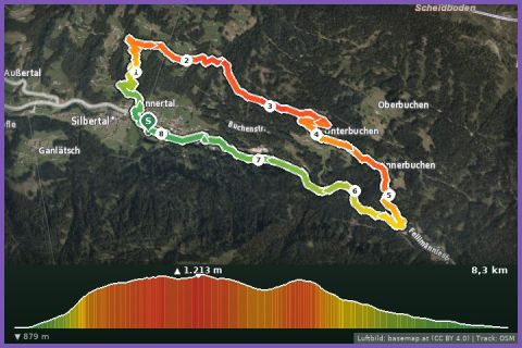
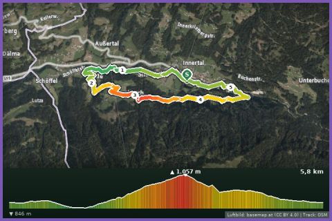
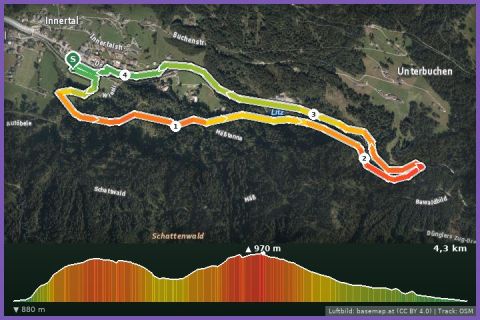
The plotted track follows the marked trails according to OpenStreetMap; see the map, elevation profile and GPX file above. Please follow the signposting on site.
The climb via the Lobsteg is steep and slippery after rain – trail shoes, poles. Refill water at the Fellimännle and at the Kneipp facility. In the high moor stay strictly on the path; walkers have priority.
Landbus 680 Schruns–Silbertal to the Kristberg cable car valley station; hiking bus into the upper Silbertal (summer). From St. Gallenkirch via Schruns approx. 35 min.
Free car park at the Kristberg cable car in Silbertal.
Last updated: 13 Sep 2026 · Map data © OpenStreetMap contributors (ODbL)