 Aerial imagery basemap.at (CC BY 4.0) · track OSM
Grabs via the Volspora to Latschau
Montafon
Aerial imagery basemap.at (CC BY 4.0) · track OSM
Grabs via the Volspora to Latschau
Montafon
easy ❄️ winter
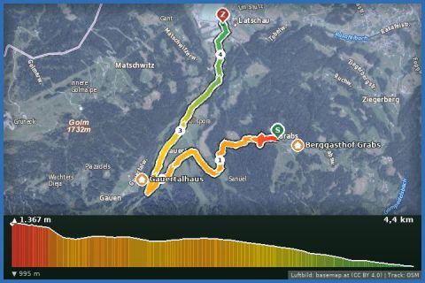
From the Berggasthof Grabs via Sanüel down to the Gauertalhaus and back through the Volspora huts – 8.4 km, 379 m of ascent, 3 hours below the Drei Türme.
Grabs is a Maisäß settlement high above Tschagguns, at around 1,370 m on the slope facing the Golm, with the Berggasthof Grabs as the starting point. From there this loop leads via Sanüel and the Volsporaweg through snowy forest down into the Gauertal, across the Rasafei stream bridge to the Gauertalhaus at 1,250 m – roughly halfway – and back up to Grabs through the Volspora Maisäß settlement. 8.37 km, 379 m of ascent, about 3 hours, moderate because of the climb back at the end; according to the provincial trail data the paths around Grabs are mostly groomed, with cleared sections in between. Above the head of the valley stand the Drei Türme, Sulzfluh and Drusenfluh, the landmark of the Montafon.
From our house it is 26 minutes by car: from Tschagguns up the Ziegerbergstraße and Grabsweg to the inn, where you park for a small fee – snow chains must be carried in winter. Without a car, walk up from Latschau over the Ziegerberg (a separate route in this guide). Refreshments at the Berggasthof Grabs (daily except Wednesday in winter, according to the operator from mid-December until shortly after Easter) and at the Naturfreunde's Gauertalhaus (winter 2025/26: 25 December to 5 April); both hire out sledges, so the walk can be combined with a toboggan run.
The route leads via Berggasthof Grabs and back to the starting point.
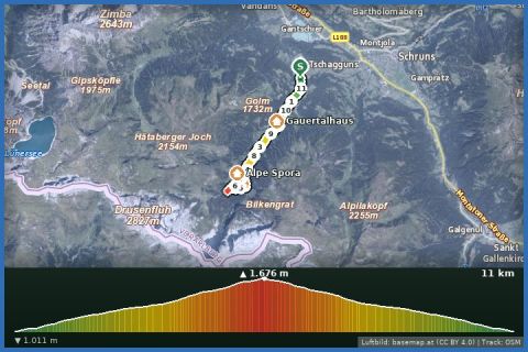
The plotted track follows the marked trails according to OpenStreetMap; see the map, elevation profile and GPX file above. Please follow the signposting on site.
Winter boots, poles and spikes for the descent into the Gauertal. The Gauertal is a side valley in avalanche terms – check the bulletin at lawine-vorarlberg.at. Look up the inns' opening hours beforehand; dogs welcome.
Landbus Montafon (lines 650/670/680) and Montafonerbahn Bludenz–Schruns; connections at vmobil.at.
Please check parking at the starting point on site (hiking car parks are usually signposted).
Emergency: Alpine rescue 140 · Euro emergency 112 · Ambulance 144
All information without guarantee. Please check weather, opening hours and cable car operating times before setting off. Alpine tours require personal responsibility, suitable equipment and experience.
Last updated: 13 Sep 2026 · Map data © OpenStreetMap contributors (ODbL)
Aerial imagery basemap.at (CC BY 4.0) · track OSM
Grabs via the Volspora to Latschau
Montafon
 Aerial imagery basemap.at (CC BY 4.0) · track OSM
Latschau through the Gauertal to the Lindauer Hütte
Tschagguns
Aerial imagery basemap.at (CC BY 4.0) · track OSM
Latschau through the Gauertal to the Lindauer Hütte
Tschagguns
 Aerial imagery basemap.at (CC BY 4.0) · track OSM
Von Latschau durchs Gauertal to the Lindauer Hut
Tschagguns
Aerial imagery basemap.at (CC BY 4.0) · track OSM
Von Latschau durchs Gauertal to the Lindauer Hut
Tschagguns